By Laura Poppick
Photographed by Jacob Bond Hessler
From our June 2023 Island Issue
When rain falls across the middle of Maine, it slides into rocky brooks that flow into narrow creeks that meet in the Penobscot River, which eventually spills into Maine’s largest bay. Penobscot Bay is dotted with more than 200 islands, the largest of which — like Isle au Haut and the Fox Islands of Vinalhaven and North Haven — host year-round communities and welcome boatloads of summer people.
But among the islands that are largely off the public radar is a 700-acre pancake of land nestled in the bay’s northwest corner, a stone’s throw south of Islesboro. Arctic terns and seagulls glide over neon-yellow lobster buoys that float off its shores. Sage-green lichen and spongy mosses blanket an understory of spruce and pine, where chipmunks collect their winter cache. On its surface, the island is much like vegetated piles of rock all across the Gulf of Maine. When famed Life magazine illustrator Charles Dana Gibson bought a piece of it as a summer getaway, in 1903, he was likely enticed by the classic Maine views and the access to woods, waters, and solitude.
But he couldn’t have known that, beneath its surface, this island was unlike most any other island in Maine, with a history that transcends those woods and waters, arcing back to an era when no animals could have scurried along its shores and no plants could have sprouted there.


Some of the tectonic activity that shaped the rocks on 700 Acre Island may have taken place during the Silurian period, roughly 444 to 419 million years ago, when what is now Maine was south of the equator and plants and animals were just beginning to live on land.
Only in the past few years have researchers confirmed that 700 Acre Island, along with a few of its neighbors, is composed of Maine’s very oldest rocks. The fieldstone with which the Gibson family built walls and walkways formed more than a billion years ago, when life consisted mostly of microbial goo. The rest of Maine’s bedrock formed much more recently, with most of it dating less than 500 million years old — still plenty ancient, but from an era when the planet was more recognizable as the place we inhabit today.
I learned of the existence of this rare patch of rock while sifting through some of the last 50 years’ worth of geologic maps of Maine, illustrations that look a bit like paint-by-number prints, with colors assigned to different rock types and ages. It’s been more than a decade since I was a geology undergrad at Bates College, and although I’ve never pursued a career in science, I’ve maintained an interest in rocks and the stories stuck within them. I find they offer a salve to the frenetic nature of the present. They can tell us, with a plain sort of wisdom, where we came from eons ago and where we might be going eons from now.
Which is why, last summer, photographer Jacob Hessler and I sought permission to visit 700 Acre Island from the extended family of Charles Dana Gibson’s heirs, who still make up the majority of its small seasonal population. With their blessing, we set out from Camden Harbor on a cool September afternoon, timing our trip with low tide to maximize rock exposure.
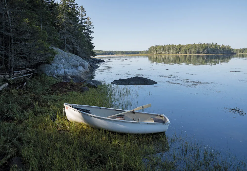
Off the northeast tip of the island, Hessler secured his lobsterboat to a mooring, and we unloaded two sea kayaks to paddle to shore. We aimed for Spruce Island, geologically indistinct from 700 Acre Island, although it’s separated from it at high tide. We pulled onto a pebbly beach, and to my deep satisfaction, found a patch of seaweed-free bedrock just a few dozen feet away. Once I hobbled my way across the intervening sliminess to the clean, dry outcrop, I hunched over it and noticed long, parallel grooves, the depth of a fingernail, etched lengthwise across the mottled black-and-tan stone: glacial striations, evidence of a mile-thick ice sheet that had clawed over this land during the last ice age.
I looked closer. Within those striations, which formed maybe 20,000 years ago, I saw much older sand grains, all glommed together with a weathered, waxy sheen. The grains looked as if they had melted together, like a pointillist painting stared at too long. I glanced around and realized the entire rock was made up of these same types of grains. Some of the geologic maps that had led me to the island had suggested these now-metamorphosed sediments had once accumulated on an ancient beach. That beach eventually became buried, deep enough in the Earth to solidify into sedimentary rock, which later, through a series of continental collisions and other tectonic events, got pushed far into the mantle, where heat and pressure turned it into what’s called metasedimentary rock.
I pressed my finger to a few gray and beige particles and was transported back in deep time, to that original beach where those grains had first rolled around. I imagined the sloshing of a shoreline that, though it was inconceivably ancient, would have had qualities we’d recognize. Tides would have ebbed and flowed. Clouds would have floated above the waves and cast shadows on the land, just as they did that afternoon over the Gulf of Maine.


The geology of the region was first mapped in the early 1900s and has since been remapped a handful of times.
After securing our boats on the beach, we kept walking the island’s perimeter and found more variations of rock — coarse and lustrous outcrops of gneiss, schist, quartzite, marble, and more. They all had a similar monotone color that, to the untrained eye, probably wouldn’t muster up much excitement. But knowing a bit of their narrative, that they’d formed alongside an ancient sea that existed before eyeballs, brains, or trees, was enough to give me goose bumps.
I ventured toward the edge of the woods and noticed a tiny, yellow-and-black monarch caterpillar, chewing on dried-up milkweed. Nearby, on the beach, I found a seal carcass draped over driftwood, its skin falling off its bones, its musky stench wafting over to where I stood. Beneath my feet I noticed a shell midden. It was left, I assumed, by the Penobscot people who frequented these islands for millennia before white settlers forced them away from this part of their ancestral homeland. I sat on the rocks just beyond the midden for some time, considering the layers and timescales of change that lay beneath me and the privilege of being able to sit there and have those thoughts.
A few weeks after our trip to the island, I reached out to Doug Reusch, a geology professor at the University of Maine Farmington, who’s been working with several colleagues in recent years to better understand the rocks of the 700 Acre Island Formation and map them in closer detail. Based on data collected in the 1970s, they’d had a hunch these were probably the oldest rocks in Maine, dating at least as far back as 543 million years, to the era known as the Precambrian. But that number had come from lab instruments that have since improved. In 2014, Reusch and a colleague collected new material to date, targeting rocks that contained zircons, tiny glassy minerals with traces of radioactive uranium. Since uranium decays into lead at a known rate, they were able to back-calculate the age of the zircon, based on its ratio of uranium to lead. When they processed their samples, they were surprised to discover that some assemblages of rock off Islesboro dated as far back as 1.8 billion years. That would make them not only Maine’s oldest rocks, but potentially New England’s oldest. “We couldn’t believe it,” Reusch told me.

That 1.8 billion years reflects the age of the parent material, some sort of igneous rock, like granite, that would have eventually eroded to form the sand that formed the beach that formed the rocks that Hessler and I visited. The age of the beach? Younger, but probably not less than a billion years.
Before those beach grains solidified into a mass of stone, Reusch suspects they tumbled around on wide, flat beaches similar to those you’d find in the Bahamas today. Quartzites, as these metamorphosed sandstones are called, of a similar age as 700 Acre’s crop up on the other side of the Atlantic, along the coast of Morocco, and there’s a possibility they were once connected on a single landmass. Geologic reconstructions suggest that, some 400 million years ago, Africa’s west coast got glommed onto North America’s east coast when a now-extinct ocean, called Iapetus, closed. That closure would eventually lead to the formation of Pangea, the planet’s most recent supercontinent, which existed until roughly 200 million years ago.
Henry Berry, senior geologist at the Maine Geological Survey, has been mapping Maine’s geology since the 1990s and says he’s never found anything quite like this sliver of stone in Penobscot Bay. There’s still a lot we don’t know about the specifics of how it formed and what happened to it thereafter, Berry told me, but what we do know goes something like this: Once upon a time, there was a continent somewhere on Earth. We don’t know where or how big or what other rocks on the Earth’s present surface were attached to it, but we have a small fragment of it represented by the 700 Acre Island Formation. We know that the rocks formed on a continent rather than in the deep sea because they contain features of environments that we find on continents today, things like coarse sand grains and remnants of land-based volcanoes. Rocks formed in the deep sea, on the other hand, contain finer silts and clays.
Whatever and wherever this continent was, it eventually got pushed or dragged inside the Earth, as deep as 10 miles, during some sort of major tectonic event (the timing is up for debate). After melting and metamorphosing within the heat and pressure of the planet’s innards, the rocks slowly creaked back up to the surface, thanks to millennia of erosion and uplift. That’s about as much as we can know, Berry said, although Reusch and a few other colleagues are heading back to the island later this year to map it in even closer detail and look for more material to date to help fill out the story.


University of Maine Farmington geology professor Doug Reusch and his colleagues will continue to fine-tune existing maps with the field work they will conduct this year.
The geologic maps that Berry and the Maine Geological Survey create are a public resource for a variety of purposes: groundwater assessments, engineering and construction, mineral exploration, and more. But when I asked him to explain his personal take on the value of learning this sort of deep geologic history, Berry paused before responding. “There’s a connectedness that these rocks are bringing to us about time and space and places that we will not experience, except through this understanding that we have constructed,” he said. “We can know what was happening one afternoon here, at that moment in time, as this layer was being deposited.”
Taury Smith, a consulting geologist who lives on Islesboro, feels similarly drawn to the rocks of the 700 Acre Island Formation, and he has made it his mission to help map them in finer detail than they have been in the past. He spends much of his free time perusing the shores of the islands and has teamed up with Reusch and others to fill in details that older maps gloss over. It’s rare to find a place with such interesting geology that hasn’t been scrutinized in close detail, he said, and he’s thrilled to help tackle that work. “It has really lit me up and captured my imagination and got me all excited,” he said. “Like a little kid.”
When I made my way back to the kayak that afternoon last year, the tide was still low, and my feet left impressions in the wet sand. I imagined some unknown future being discovering those prints, many millennia from now, and I felt a closeness to them, imagined how they might marvel at that mark left one afternoon in the 2020s. Then I nudged the boat off the shore, paddling into the wind and the rest of the day ahead.
This story has been edited from its print version to reflect that the majority, not entirety, of owners on 700 Acre Island have a connection to Charles Dana Gibson’s heirs.